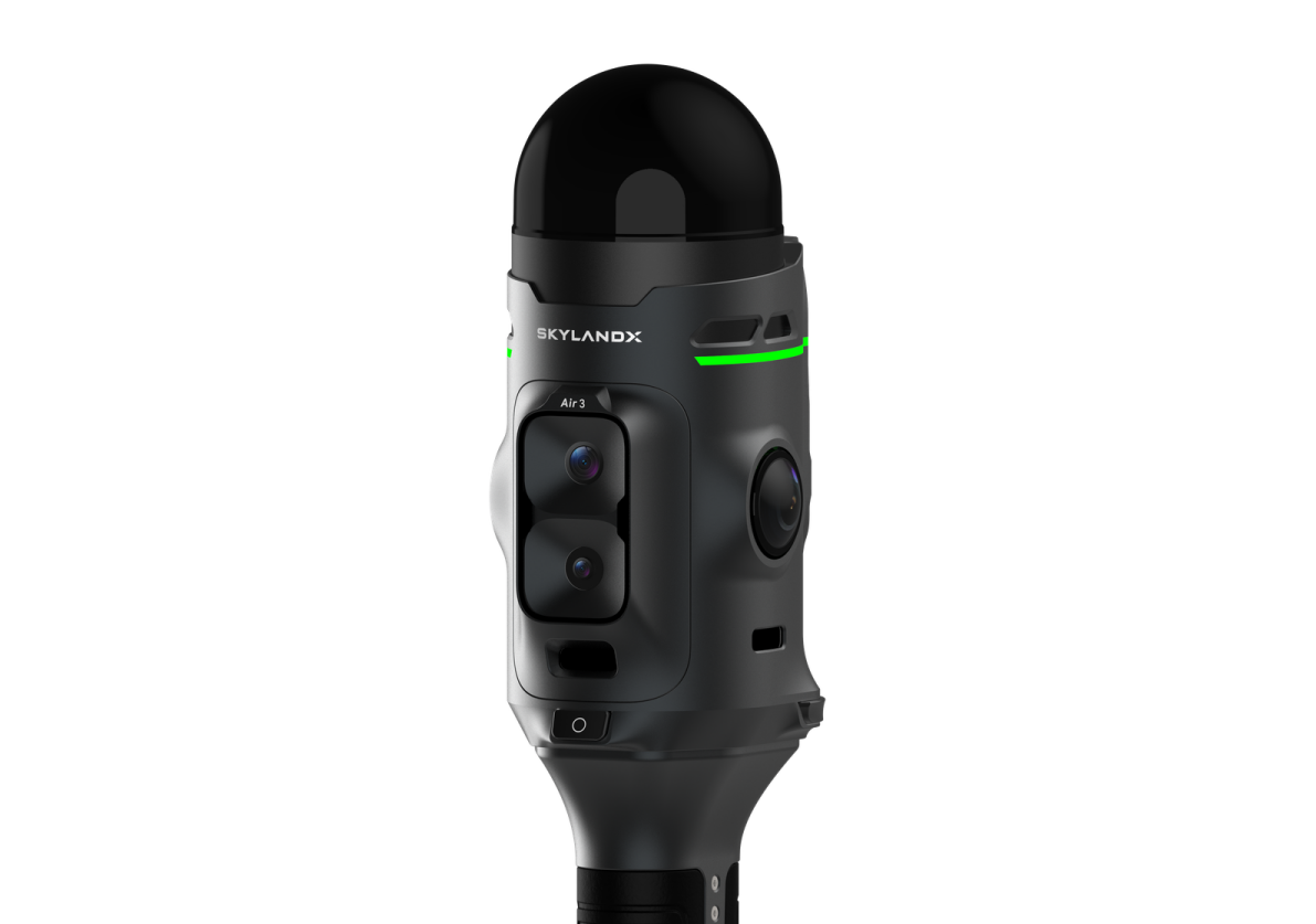
SkylandX has introduced the MetaCam Air 3, a new handheld reality-capture system unveiled at Intergeo 2026. The company describes it as a fundamental redesign of handheld 3D scanning rather than an incremental upgrade, building on the integrated handheld scanner SkylandX launched in 2023, of which it has delivered more than 5,000 units, supporting the capture of over 1 billion square meters of real-world environments.
At the core of the device is an in-house Lidar system with a 360° x 240° field of view, engineered specifically for high-precision surveying rather than adapted from automotive or robotics sensors. A smaller laser spot delivers finer detail, a high point rate supports dense data capture, and the wide field of view records both floor and ceiling in a single pass, reducing blind zones and repeat scans. SkylandX calls it "the industry's only handheld reality-capture system built around a self-developed, survey-grade Lidar." The Lidar is paired with dual 50MP panoramic color cameras, a 48MP forward-facing camera and a dedicated global-shutter camera for visual SLAM.
Positioning options have been expanded to include network RTK via NTRIP, local RTK via UHF, plus PPK and ground-control-point workflows, with a removable RTK module and a magnetically attached UHF radio letting users configure the device per project. The physical design was also reworked, adding a visual indicator called the "Mars Ring" that displays real-time SLAM accuracy and system status, along with a one-button start function.
"We did not design Air 3 around the limits of an existing sensor. We started with the data that survey professionals actually need, then redesigned the core Lidar and the complete product experience around it," said Stuart Situ, CTO at SkylandX. "Air 3 advances individual performance while bringing accuracy, coverage, imaging, positioning, and usability together in one platform."
Once captured, data flows into SkylandX's software environment for review, editing, processing and export, linking field acquisition directly to final spatial-data delivery.